TASK 1:
Question: The maps show the changes to a village in England called Stamdorf between 1985 and 2015.
ANSWER:
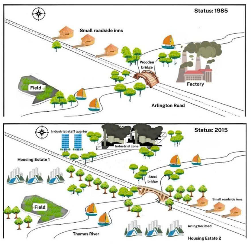
The maps illustrate the changes that took place in a village in England called Stamford between 1985 and 2015. Overall, the village underwent considerable development during the 30-year period. New housing estates and a large industrial zone were introduced, while the area also became noticeably greener with many more trees planted.
In 1985, the Thames River flowed across the southern part of the village. Arlington Road ran diagonally through the area and crossed the river via a wooden bridge. Several small roadside inns were situated along the northern side of this road, while a factory occupied the northeastern corner of the map. To the southwest, there was a field beside the river, and only a small number of trees were scattered along the riverbank and the roadside.
By 2015, the village had experienced significant expansion. The factory area had been redeveloped into a much larger industrial zone, and an industrial staff quarter was built nearby. Two residential areas were also constructed, including Housing Estate 1 to the northwest of Arlington Road and Housing Estate 2 to the southeast near the river. In addition, the original wooden bridge was replaced with a steel bridge. The small roadside inns were relocated to the southeastern side of the road, and a substantial number of trees had been planted throughout the village, particularly along the river and surrounding the new developments.
(227 words)
