TASK 1:
Question: The maps below show part of a village in 1910, and the same part of that village in 2010.
ANSWER:
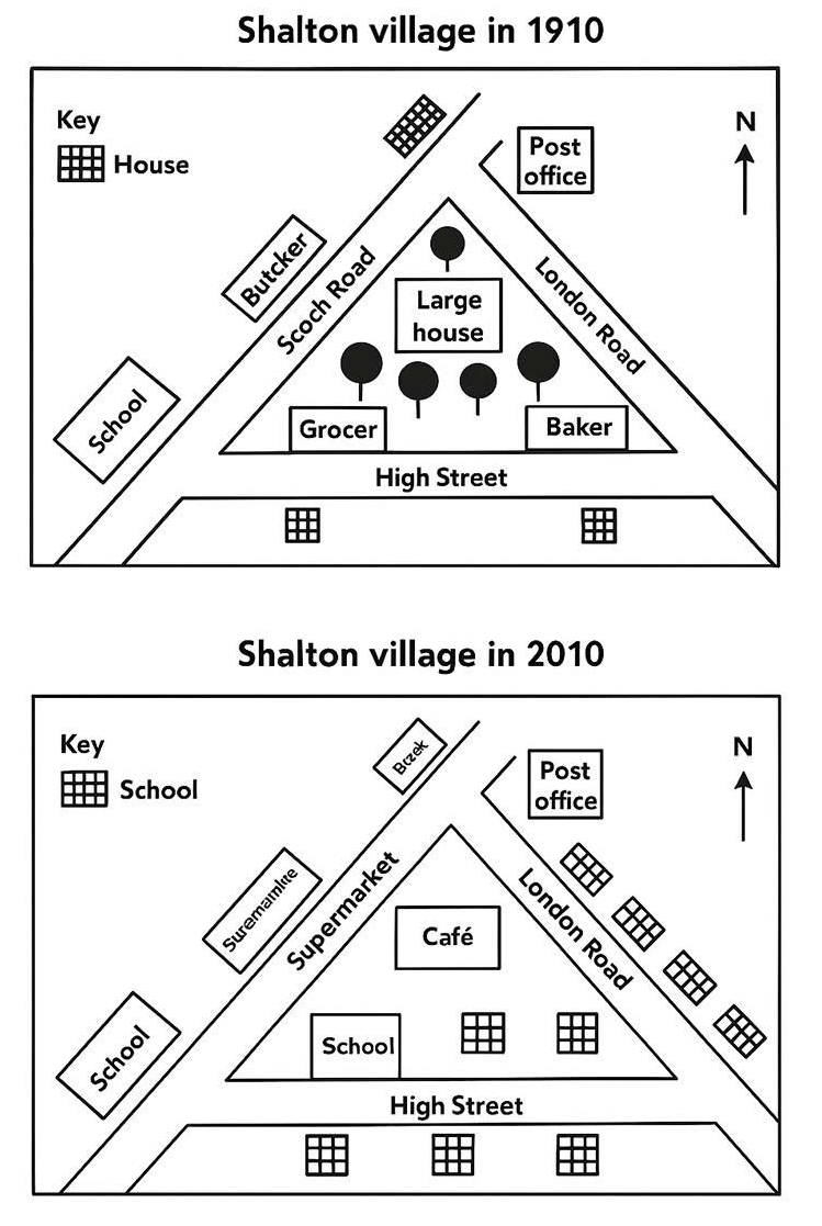
The two maps illustrate how part of Shalton village changed between 1910 and 2010.
Overall, the village became more densely residential , alongside the removal of greenery and the introduction of commercial facilities.
Concerning the structure, the settlement is organized around three main roads. School Road ran from the southwest to the northeast, High Street along the south, and London Road stretching from the northeast to the southeast, forming a triangle.
The central zone inside the triangle featured a large house surrounded by trees in the middle, while along its southern edge stood a grocer, a block of housing, and a baker. By 2010, the large house and its greenery had been demolished to make way for several new residential blocks lining a curved access road. Moreover, the grocer and the baker were replaced by a cafe and an additional housing block, respectively.
Regarding the outskirts, originally, a school, a butcher shop, and a housing row were situated along School Road, while a post office lay to the east of the northern T-junction. Over the next century, the school and the post office were retained; however, the butcher’s shop was replaced by a supermarket with a car park, whereas the houses were converted into a bank.. Finally, more dwellings were erected along London Road and High Street. (216 words)
