TASK 1:
Question: The two maps illustrate the significant changes that took place in the town of Dalton between the years 1815 and 2015.
ANSWER:
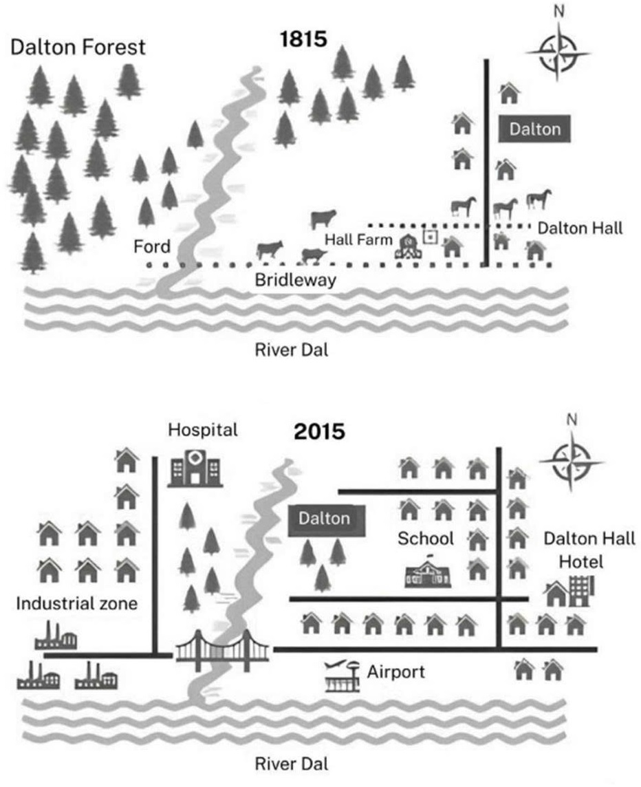
The two maps illustrate how the town of Dalton changed dramatically between 1815 and 2015. Overall, Dalton was transformed from a rural and agricultural settlement into a highly developed urban area with extensive infrastructure, housing, and public services. While forests, farmland, and scattered houses dominated the early landscape, these were largely replaced by industrial, residential, and transport facilities two centuries later.
In 1815, the west of Dalton was almost entirely covered by Dalton Forest, with a ford providing the only crossing point over the River Dal. There was also a bridleway linking Hall Farm to the river. By 2015, this rural setting had disappeared, as most of the forest was cleared to make way for new facilities. A large industrial zone and an airport were constructed along the southern bank, while a bridge replaced the ford to provide modern access across the river. Furthermore, a hospital and rows of residential houses emerged.
In contrast, the eastern side of Dalton in 1815 featured Hall Farm, open fields, and only a few houses near Dalton Hall. By 2015, this area had expanded significantly, with the construction of a school, a hotel, and numerous new houses organized along modern road networks. Dalton Hall remained in place but was now surrounded by dense urban development. The small village had also grown into a defined town center. (222 words)
