TASK 1:
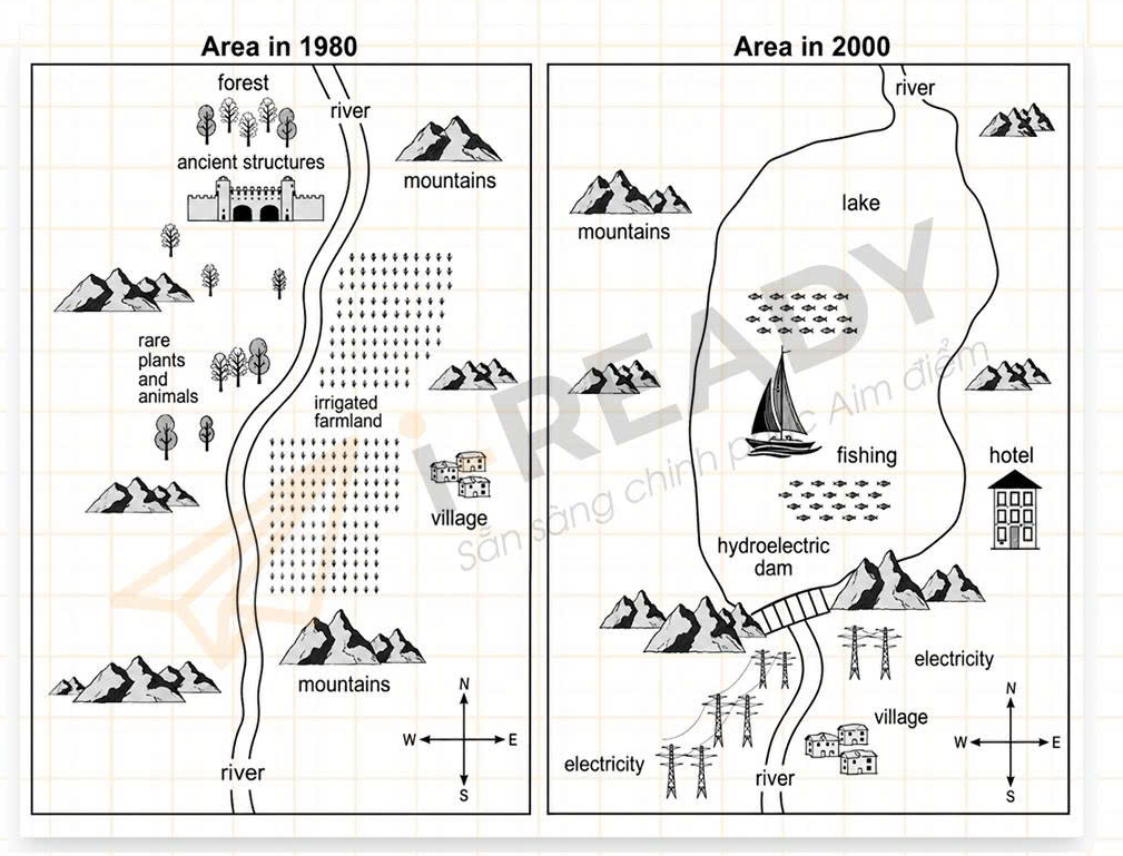
Question: The maps below show the changes in area after the construction of a hydroelectric power dam.
ANSWER:
The two maps illustrate the changes that occurred in a certain area between 1980 and 2000, following the construction of a hydroelectric power dam.
Overall, the most significant change was the transformation of the river into a large lake, which submerged several natural and man-made features. Additionally, the area became more commercialized, with the appearance of a hotel and electricity infrastructure.
In 1980, the area was characterized by a wide range of natural habitats and human settlements. A river flowed vertically through the region, bordered by a forest to the north, rare plants and animals in the central-west, and irrigated farmland to the east. There were also a village and some ancient structures located along the river.
By 2000, the river had been dammed, forming a large lake in its place. As a result, the forest, rare species, farmland, ancient ruins, and most of the river had been completely submerged. A fishing area appeared in the lake, and the hydroelectric dam was constructed at the southern end of the water body. To the east of the lake, a hotel was built, indicating a shift toward tourism. Meanwhile, electricity lines were installed in the lower part of the map, providing power to the remaining village.
(206 words)

